 Day One- Wyoming
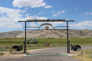
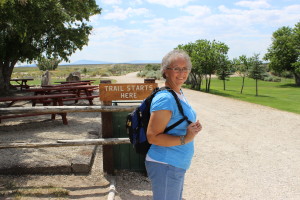
We have always wanted to see Martin’s Cove and finally were able to include it in a trip. I read some history of the handcart company to Scott on the drive there so he was up to speed on the history. We assumed we would have to do some walking but didn’t do our homework beforehand and discovered on arrival that the hike to the cove is a 5.2 mile round trip on a very hot day. We loaded the backpack with water bottles and set out, confident that we could do it. We did, of course, but we were hot and sweaty by the end.
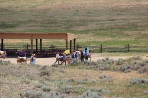
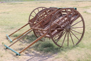 We passed several groups of youth Trekkers on the trail and got a feel for the boys’ teenage experience here with our neighborhood group. The Mormon visitor center is at the Sun Ranch by Devil’s Gate and the Martin Company moved from there to the cove in a heavy snowstorm with over a foot of snow on the ground in an attempt to shelter themselves somewhat from the storm and wait it out. I found the actual area much different from what I imagined from the accounts. This is why geography is so important to historians. I can read and imagine but whenever I get out on the actual ground of an historical event I am always surprised at how much my understanding of the event increases. When looking at the terrain from different vantage points it usually becomes obvious why the people made the choices they did and how the ground affected those choices. The original accounts called the sheltered area “Martin’s Ravine” and the name was later changed to Cove; I don’t know why.
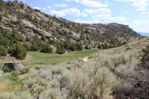 But it is totally a U-shaped ravine and they camped in the curved section which is at the far end of the ravine. When I saw it in person it made sense why they attempted the move, which was described as difficult and the members of the company unwilling due to the sub-zero temperatures, their exhaustion, and lack of rations for days. The rescuers encouraged them to do it, knowing their survival depended on it. The visit to the actual cove was profoundly moving and I’m very glad we went.
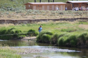 The Sweetwater River meanders and loops back on itself all and the pioneers crossed it many times in the journey west. The Martin Company had to cross it in the snow with ice chunks in the water in their move to the Cove. The river is not deep but it’s wide.
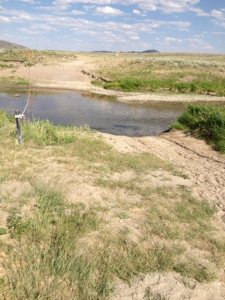 We hiked down from the cove and moved out along the sand trail by the Sweetwater River. It was slow going through the soft sand and my tennis shoes have a mesh top, so every step put sand into my shoes. By the time we reached the visitor center, all the loose area around my toes was filled with sand and they couldn’t wiggle. As we were slogging along this sand trail I made the observation to Scott that this was an interesting experience to actually be out on the prairie on foot. When you’re driving the interstate you can look around and see the vast expanses of the west and marvel at how big it is. But you cover a lot of ground at 70 mph and there are few places to get out and really walk, as there are fences lining the interstate and any walking areas are short trails along the road. We were out on the prairie and had been walking for a long time and when we looked around and it didn’t seem like we had gone very far in that big open space. I really got a sense of how far it must have been to walk 15 miles in a day and look back to see the same panorama and feel like you weren’t making much progress in that vast land. It was a moving experience I had not expected to have.
Since we had been there all afternoon we didn’t spend much time in the center with our long drive ahead, and we felt pretty grounded in the history. But it’s a very nice center with tour guides and interpretative displays. We drove up the road a few miles to Independence Rock and walked 3/4 of the way around as were pretty tired and hot. We only saw a couple signatures so I was disappointed as I know I’ve seen photos of many all together. So either they are on the area we didn’t get to or they are eroded.

Leave a Reply